After a rather pleasant end to July, a broad area of low pressure in the north Atlantic will introduce more unsettled conditions for the August bank holiday weekend. This low pressure will steer frontal systems across Ireland, with spells of heavy rain expected on Sunday and Bank Holiday Monday, coupled with fresh to strong and gusty southerly winds along Atlantic coasts.
Met Éireann forecaster Aoife Kealy said “We’ll see the first of many fronts tracking eastwards across the country today (Friday), bringing much wetter conditions than we’ve had over the last few days. There will be some heavy or thundery downpours associated with that. Once that front clears through, it will introduce fresher conditions for Saturday. Though the temperatures will drop back to the mid to high teens, there’ll be plenty of dry spells and some sunshine between the scattered showers.”
The drier and brighter weather will be short-lived, as the next low pressure system in the north Atlantic drives further weather fronts across Ireland on Sunday and Monday.
Aoife explained “This low pressure system will drag a warm, moist airmass with it from the mid-Atlantic. That warm, moisture-laden air will act like fuel for this system, meaning the rain that it brings will be heavy.”
Through Sunday afternoon and much of Monday, that heavy rain will move eastwards across the country. The rain will be heaviest in the west and southwest with flooding possible. Becoming blustery also, with fresh and gusty southerly winds developing, strong on western and southern coasts.
It will also be very mild on Sunday night due to the warm airmass that the low pressure system will introduce. Temperatures will not fall below 14 to 17 degrees, so it will be an uncomfortable night for sleeping.
Aoife continued “With the bank holiday weekend, more people will be out and about and they may not expect the unseasonably wet weather and strong winds. Sunday will not start off too bad but don’t let that lull you into a false sense of security. The rain will get progressively heavier through the afternoon and evening with those southerly winds picking up, so make sure to check the forecast and any warnings for your area before heading out.”
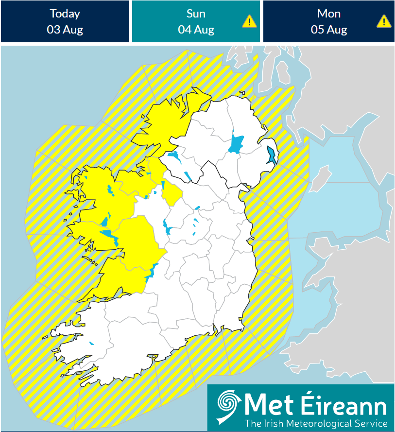
Yellow warnings have been issued for heavy rainfall for counties Clare, Donegal, Galway, Leitrim, Mayo and Sligo from Sunday afternoon running through Monday afternoon.
Potential impacts:
- Localised flooding
- Damage to temporary structures
- Difficult travel conditions
- Poor visibility
Stay in contact with the forecast over the coming days for the most up to date information on met.ie and on the Met Éireann app, particularly if planning outdoor activities.
Looking ahead to next week, current indications suggest that while it will be largely unsettled with showers and rain at times, no further impactful weather is expected.