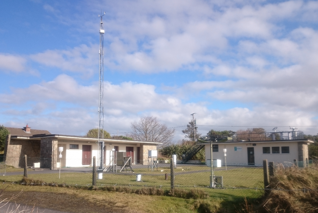
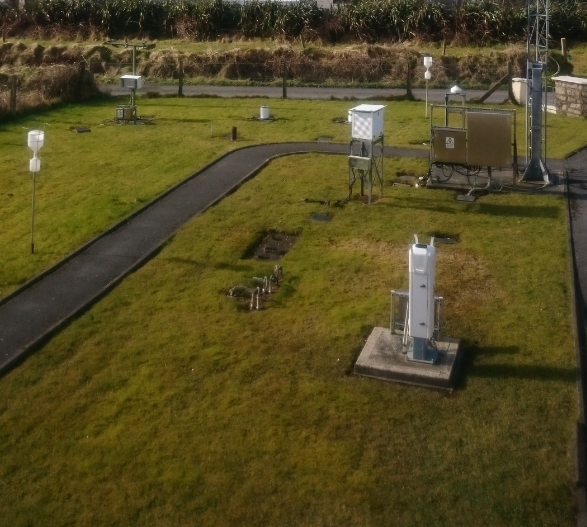
Please choose a Weather Observing Station from the options below
Further information available about Met Éireann’s Weather Observation Network on What We Measure
Athenry
Athenry AWS is situated within the grounds of Teagasc, Athenry, Co Galway and was installed in 2010. Daily rainfall readings were taken at Athenry from 1944 to 1975.
The following parameters are currently recorded at the station:
- Air Temperature
- Soil Temperatures
- Earth Temperatures
- Grass Temperature
- Rainfall
- Wind speed and Direction
- Atmospheric Pressure
- Relative Humidity
- Global Radiation
Location
53°17‘21” N
08°47’08’’ W
40 m above mean sea level
Ballyhaise
Ballyhaise AWS is situated within the grounds of Teagasc, Ballyhaise, Co Cavan and was installed in 2003. The station replaced a synoptic station which closed at Clones, Co Monaghan in 2008. A manual climate station taking daily measurements was situated within the college from 1932 to 2005.
The following parameters are recorded at the station:
- Air Temperature
- Soil Temperatures
- Earth Temperatures
- Grass Temperature
- Rainfall
- Wind speed and Direction
- Atmospheric Pressure
- Relative Humidity
- Global Radiation
- Cloud height and amount
- Present Weather
Location
54°03‘05” N
07°18’35’’ W
78m above mean sea level
Belmullet
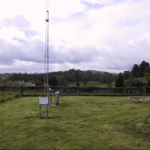
The station opened in September 1956. It replaced the station at Blacksod Lighthouse, 10 miles to the SW, which was run by the Sweeney family. It was from Blacksod that the observation, which finally determined the date of the D-Day landings in June 1944, emanated. The station is regarded as being particularly important because of its location on the western fringe of Europe. In 2012, the manual station was replaced by an AWS situated on the same site
The following parameters are recorded at the station:
-
- Air Temperature
- Soil Temperatures
- Earth Temperatures
- Grass Temperature
- Rainfall
- Wind speed and Direction
- Atmospheric Pressure
- Relative Humidity
- Global Radiation
- Cloud height and amount
- Present Weather
Location
54°13‘39” N
10°00’25’’ W
9 m above mean sea level
Carlow Oakpark
Oak Park AWS is situated within the grounds of Teagasc, Oak Park, Co Carlow.
The AWS was installed in 2003 and replaced a manual climate station which has taken daily readings since 1957
The following parameters are measured at the station:
-
-
- Air Temperature
- Soil Temperatures
- Earth Temperatures
- Grass Temperature
- Rainfall
- Wind speed and Direction
- Atmospheric Pressure
- Relative Humidity
- Global Radiation
- Cloud height and amount
- Present Weather
-
Location
52°51‘40” N
06°54’55’’ W
62 m above mean sea level
Claremorris
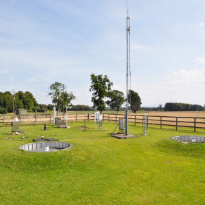
Claremorris meteorological station is situated about 2 Km south of the centre of the town.
The station opened on the 9th November 1943 as a fully manned synoptic station. The manual station was replaced by an AGI automatic station in 1996. The station at Claremorris was officially closed on 1st November 2010 and was replaced by a TUCSON* Automatic Weather Station at the same location from January 1, 2010.
*TUCSON (Total unified climatological and synoptic observation network)
The following parameters are measured at the station:
-
-
- Air Temperature
- Soil Temperatures
- Earth Temperatures
- Grass Temperature
- Rainfall
- Wind speed and Direction
- Atmospheric Pressure
- Relative Humidity
- Global Radiation
-
Location
53°42’39” N
8°59’33” W
68 M above mean sea level
Dunsany
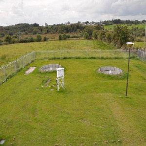
The AWS is situated within the grounds of Teasgasc Grange, Boycetown, Co Meath. The present station was commissioned in 2006 replacing a manual climate station which was installed in 1963.
The following parameters are recorded at the station:
-
-
- Air Temperature
- Soil Temperatures
- Earth Temperatures
- Grass Temperature
- Rainfall
- Wind speed and Direction
- Atmospheric Pressure
- Relative Humidity
- Global Radiation
-
Location
53°30‘57” N
06°39’36’’ W
83 m above mean sea level
Fermoy Moorepark
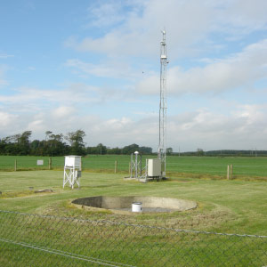
Moore Park AWS is situated within the grounds of Teagasc, Moore Park,
Co Cork and was installed in 2003. The station replaced a manual station which was situated on the site since 1961.
The following parameters are measured at the station:
-
-
- Air Temperature
- Soil Temperatures
- Earth Temperatures
- Grass Temperature
- Rainfall
- Wind speed and Direction
- Atmospheric Pressure
- Relative Humidity
- Global Radiation
-
Location
52°09‘50” N
08°15’50’’ W
46 m above mean sea level
Finner
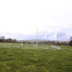
The current automatic weather station (AWS) was installed in Finner Army camp, Ballyshannon, Co. Donegal on the 1st November 2010. It replaced an existing AWS which had taken measurements
since April 1996.
The following parameters are recorded at the station:
-
-
- Air Temperature
- Grass Temperature
- Rainfall
- Wind speed and Direction
- Atmospheric Pressure
- Relative Humidity
- Global Radiation
- Cloud Height and Amount
- Present Weather
-
Location
54°29‘38” N
08°14’35’’ W
33 m above mean sea level
Gurteen
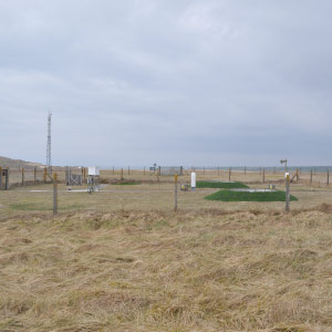
Gurteen AWS was opened in the grounds of Gurteen Agricultural College, Co Tipperary in April 2008. The station was opened as a replacement to Birr Synoptic station which officially closed on the 1st January 2009.
The following parameters are recorded at the station:
-
-
- Air Temperature
- Soil Temperatures
- Earth Temperatures
- Grass Temperature
- Rainfall
- Wind speed and Direction
- Atmospheric Pressure
- Relative Humidity
- Global Radiation
- Cloud height and amount
- Present Weather
-
Location
53°03‘11” N
08°00’31’’ W
75 m above mean sea level
Johnstown Castle
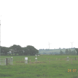
Johnstown Castle AWS is situated within the grounds of Teagasc, Johnstown Castle, Co Wexford. An initial AWS was installed in 2003 and replaced a manual station which had taken daily measurements since 1914. Due to anthropogenic developments impacting on exposure the AWS was moved to a new location within the Teagasc grounds in 2009.
The following parameters are recorded at the station:
-
-
- Air Temperature
- Soil Temperatures
- Earth Temperatures
- Grass Temperature
- Rainfall
- Wind speed and Direction
- Atmospheric Pressure
- Relative Humidity
- Global Radiation
- Cloud height and amount
- Present Weather
-
Location
52°17‘52” N
06°29’48’’ W
62 m above mean sea level
Mace Head
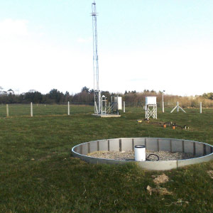
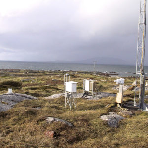
The AWS at Mace Head is situated within the grounds of the NUI , Galway research centre near Carna, Co Galway. The station was installed in 2003.
The following parameters are currently recorded:
-
-
- Air Temperature
- Wind speed and direction
- Rainfall
- Atmospheric Pressure
- Relative Humidity
- Global Radiation
- Cloud height and amount
- Present Weather
-
Location
53°19‘33” N
09°54’03’’ W
21 m above mean sea level
Malin Head
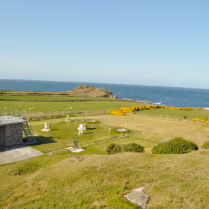
Malin Head synoptic weather station is situated at the most northerly point on the island of Ireland, at the top of the Inishowen peninsula in County Donegal. The nearest town is Carndonagh, which is 19 Km south southeast of the station.
The present buildings were constructed in 1955, when regular hourly weather observations commenced by Irish Meteorological Service personnel. However, the station records go back to 1885. Personnel employed by Lloyd’s Insurance Company, who manned and operated a local coastal signal station, were first to prepare and transmit regular weather reports. Coastguard officers continued this work until the early twenties. From the 1920’s to 1955 a local family was contracted to provide climate data and at least one weather report each day.
The weather element which distinguishes Malin Head from the other stations throughout the country is wind speed. Storm force 12 winds are recorded at the station during most years. The highest measured gust to date is 98 knots, recorded on 16th September 1961 when the remnants of “Hurricane Debbie” swept up along the west coast of Ireland causing widespread damage in this part of the country.
The manual weather station at Malin Head was officially closed on 31st December 2009 and was replaced by an Automatic Weather Station at the same location from 1st January 2010.
The following parameters are measured at the station:
-
-
- Air Temperature
- Soil Temperatures
- Earth Temperatures
- Grass Temperature
- Rainfall
- Wind speed and Direction
- Atmospheric Pressure
- Relative Humidity
- Global Radiation
- Cloud height and amount
- Present Weather
-
Location
55°22’20” N
7°20’20” W.
22 M above mean sea level
Markree
Quality controlled minute data available from 20-Aug-2007.
Quality controlled daily data available from 1941 to 1998 (old station).
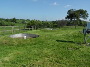
Markree Castle AWS is situated close to Markree Castle, Co Sligo.. The present station was commissioned in 2005 replacing a manual climate station which measured daily temperature and rainfall from 1860 to 1998. Due to site exposure, wind in not measured at the station.
The following parameters are recorded at the station:
-
-
- Air Temperature
- Soil Temperatures
- Earth Temperatures
- Grass Temperature
- Rainfall
- Atmospheric Pressure
- Relative Humidity
- Global Radiation
-
Location
54°10‘30” N
08°27’20’’ W
34 m above mean sea level
Mount Dillon
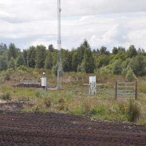
The AWS is situated on Bord Na Mona land north of Lanesborough. It was installed in September 2003.
The following parameters are recorded at the station:
-
-
- Air Temperature
- Soil Temperatures
- Earth Temperatures
- Grass Temperature
- Rainfall
- Wind speed and Direction
- Atmospheric Pressure
- Relative Humidity
- Global Radiation
-
Location
53°43‘37” N
07°58’51’’ W
39 m above mean sea level
Mullingar
Mullingar AWS is situated to the west of Mullingar, Co. Westmeath.
The station was automated in 1998.
The following parameters are recorded at the station:
-
-
- Air Temperature
- Soil Temperatures
- Earth Temperatures
- Grass Temperature
- Rainfall
- Wind speed and Direction
- Atmospheric Pressure
- Relative Humidity
- Global Radiation
- Cloud height and amount
- Present Weather
-
Location
53°32‘14” N
07°21’44’’ W
101 m above mean sea level
Newport
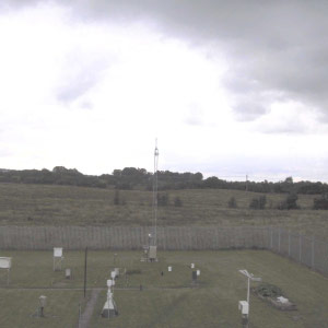
Newport (Furnace) AWS is situated within the Marine Institute research centre to the North-West of Newport, Co Mayo. The station is positioned on an isthmus separating Lough Feegh (fresh water) and Lough Furnace (salt water) .The present station was commissioned in January 2005 replacing a daily manual climate station which was installed in 1959.
The following parameters are recorded at the station:
-
-
- Air Temperature
- Soil Temperatures
- Earth Temperatures
- Grass Temperature
- Rainfall
- Wind speed and Direction
- Atmospheric Pressure
- Relative Humidity
- Global Radiation
-
Phoenix Park
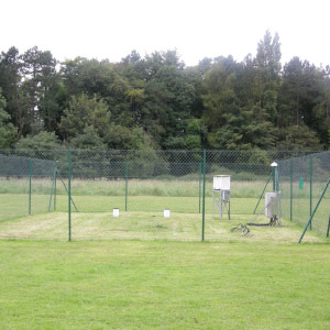
The Phoenix Park AWS is situated within the grounds of the Ordnance Survey of Ireland in the Phoenix Park, Dublin. The current station was installed in 2003 and replaced a manual climate which was established in 1829.
The following parameters are recorded at the station:
-
-
- Air Temperature
- Soil Temperatures
- Earth Temperatures
- Grass Temperature
- Rainfall
- Atmospheric Pressure
- Relative Humidity
- Global Radiation
-
Location
53°21‘50” N
06°20’00’’ W
48 m above mean sea level
Roches Point
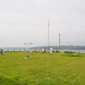
Roches Point AWS is situated in the south eastern tip of Cork Harbour. The present station was commissioned in 2004 replacing an older AWS which was installed in 1991. Prior to this, Roches Point was a fully manned synoptic station measuring hourly data since 1940.
The following parameters are recorded at the station:
-
-
- Air Temperature
- Soil Temperatures
- Earth Temperatures
- Grass Temperature
- Rainfall
- Wind speed and Direction
- Atmospheric Pressure
- Relative Humidity
- Global Radiation
- Cloud height and amount
- Present Weather
-
Location
51°47‘35” N
08°14’40’’ W
43 m above mean sea level
Sherkin Island
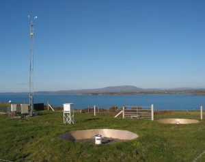
Sherkin Island AWS is situated within the grounds of the Sherkin Island Marine Station, Co Cork. The island is situated approximately 2 km off the west Cork village of Baltimore. The station is situated on north-west end of the island and was commissioned in 2004. A manual climate station measuring
daily rainfall and temperature was installed in 1972 and remains open.
The following parameters are recorded at the station:
-
-
- Air Temperature
- Soil Temperatures
- Earth Temperatures
- Grass Temperature
- Rainfall
- Wind speed and Direction
- Atmospheric Pressure
- Relative Humidity
- Global Radiation
- Cloud height and amount
- Present Weather
-
Location
51°28 ‘35” N
09°25’40’’ W
21 m above mean sea level
Valentia
Valentia Observatory is part of Met Éireann, the Irish Meteorological Service. It is located one kilometre west of the town of Cahirciveen, on the estuary of the Feartha river. The Observatory carries out surface weather and upper-air meteorological measurements, as well as a wide range of other scientific activities including ozone monitoring, geomagnetics, seismology, solar radiation and environmental monitoring. The Observatory is called Valentia because it was originally located on Valentia Island.
The following parameters are recorded at the station:
-
-
- Air Temperature
- Soil Temperatures
- Earth Temperatures
- Grass Temperature
- Rainfall
- Wind speed and Direction
- Atmospheric Pressure
- Relative Humidity
- Global Radiation
- Cloud height and amount
- Present Weather
-
Location
Location
51° 56′ 23″N
10° 14’40″W
25M above mean sea level
Information on Met Éireann weather stations at Airports / aerodrome
