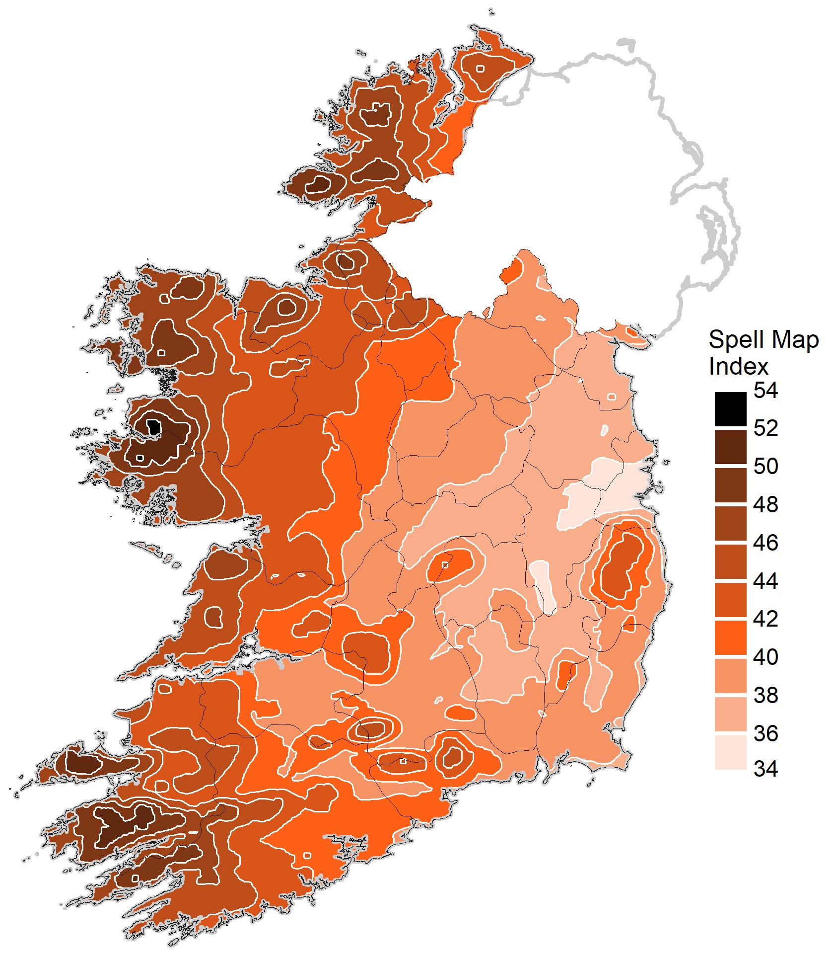
The climate of Ireland is changing. Consequently, the Department of Housing, Local Government and Heritage funded a Met Éireann’s project to update ‘Climate maps and data to support building design standards in Ireland’. The motivation of this research was to produce, for the first time, a map of Driving Rain Index for Vertical Surfaces according to I.S. EN ISO 15927-3:2009 and based on hourly data from the latest climate normal 1991 – 2020 for use in building design to enhance resilience in support of climate change adaptation in Ireland.
Wind-driven rain against a wall may be partially absorbed or penetrate through cracks in the wall, therefore increasing the risk of damage to the building fabric. Rain penetration through gaps and cracks in building façades and around the edges of doors and windows usually occurs after short periods of heavy rainfall accompanied by winds. The impacts of rain on buildings depend on the rain intensity, duration, wind speed and wind direction.
The outputs of this research will benefit a wide range of decision makers currently collaborating with Met Éireann, such as the National Standards Authority of Ireland, ARUP and the Department of Housing, Local Government and Heritage. This report will also inform policy in delivering key national infrastructure such as housing and building renovation.
The new map supersedes the previous map published by Met Éireann in 2010 and 2023 and should be adopted by decision makers. It is hoped that the detailed explanation of the application of the I.S. EN ISO 15927-3:2009 methodology will be of assistance to regulators elsewhere in adopting this methodology in their own jurisdictions.
Read the full report:
Mateus, C., and Coonan, B. 2024. Distribution of driving rain in Ireland. Climatological Note No. 17. Met Éireann. http://hdl.handle.net/2262/101280
Report ![]() This work is licensed under a Creative Commons Attribution-NonCommercial-ShareAlike 4.0 International License.
This work is licensed under a Creative Commons Attribution-NonCommercial-ShareAlike 4.0 International License.

Spell map index (mS) of driving rain against vertical surfaces for the period 1991 – 2020 for Ireland (I.S. EN ISO 15927 32009).