Réamhaisnéis limistear na farraige
Forecast valid from: 12:00, Sunday 02 August 2026 until 12:00, Monday 03 August 2026
Small Craft Warning
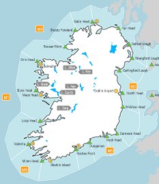
1. Southeast to east winds will reach force 6 through the period on Irish coasts from Mizen Head to Loop Head to Erris Head.
2. East to northeast winds will reach force 6 at times Monday morning on Irish coasts from Belfast Lough to Strangford Lough to Howth Head.
Gale Warning
Nil
Meteorological Situation at 09:00 UTC
A light to fresh southeasterly airflow covers Ireland generated by an anticyclone of 1022Pa, centred over mainland Europe, and a depression of 1005hPa, centred approximately 310 nautical miles southwest of Valentia. Associated frontal toughs are approaching from the southwest.
Small Craft Warning: In effect
Heavy Swell (>4m) : No
Forecast for Roches Point to Loop Head to Erris Head
Wind: Southeast or east force 4 to 6 imminent. Later increasing force 7 at times.
Weather: Cloudy with outbreaks of rain and drizzle, heavy at times. Mist patches.
Visibility: Moderate to poor in precipitation and mist.
Forecast for Erris Head to Belfast Lough to Roches Point and for the Irish Sea
Wind: Easterly or variable force 2 to 4. Soon increasing east or northeast force 3 to 5. Later increasing easterly mainly force 4 or 5, occasionally force 6. Decreasing southeast to east force 3 to 5 by the end of the period.
Weather: Mostly cloudy with patchy rain and drizzle at times. Mist or fog patches possible. Outbreaks of rain in the south later.
Visibility: Decreasing moderate or poor in any precipitation, mist or fog.
Outlook for a further 24 hours until 12:00, Tuesday 04 August 2026
Mostly moderate to strong east to southeast winds will decrease mostly moderate to fresh cyclonic variable by early Monday night. Winds will further decrease mostly light to moderate, occasionally fresh through Monday night and Tuesday morning. Weather: Showery outbreaks of rain, heavy or thundery at times.
Forecast issued at: 12:00, Sunday 02 August 2026
All times are local unless specified