Forecast issued at: Friday 25th April 2025 12:00
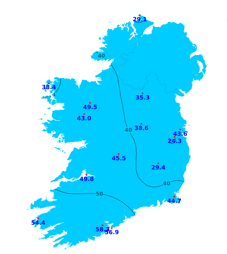
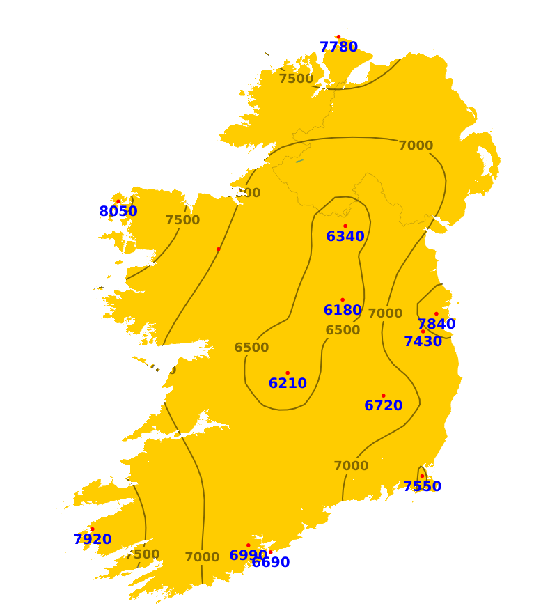
Rain
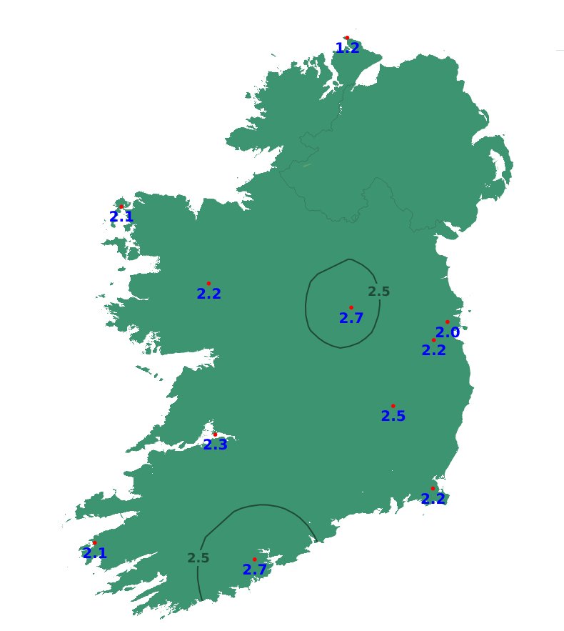
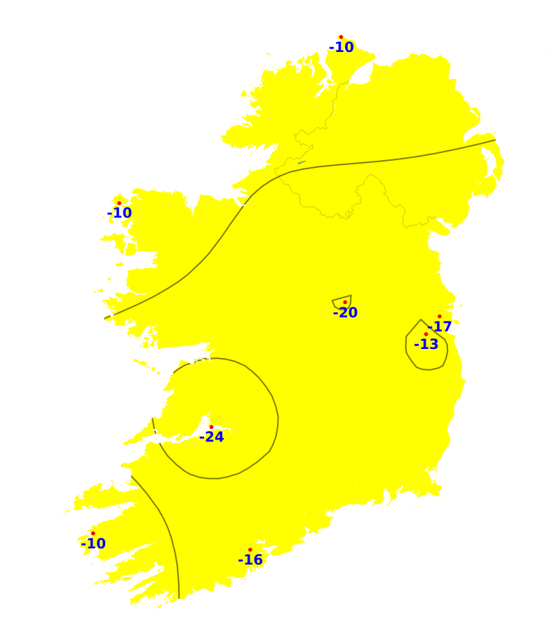
It has been much wetter than normal over the past week, with rainfall amounts between 2.5 and 6 times the average in most areas. It was wettest near south and southeast coasts with 92.5mm recorded at Roches Point, Co. Cork (667% of normal). Accumulations were lower further north, with rainfall amounts coming in twice the average in Donegal. 35.3mm was recorded at Malin Head, Co. Donegal (212% of normal). The next seven days in contrast will trend much drier than normal, with less than 10mm forecast in most areas.
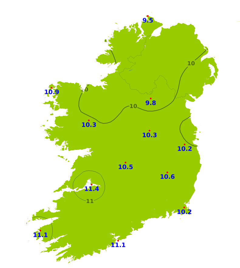
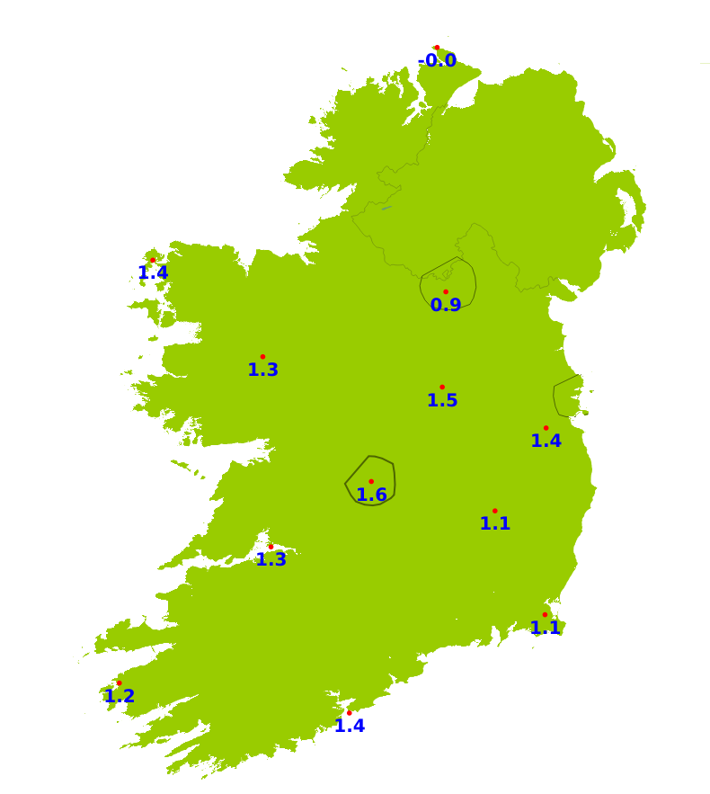
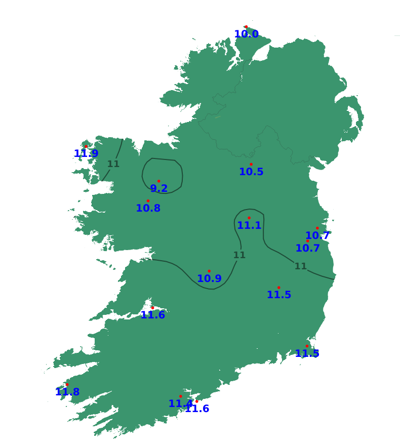
Temperatures
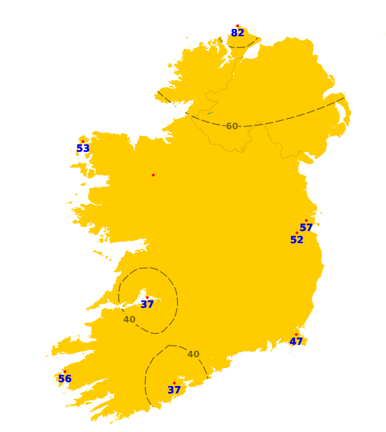
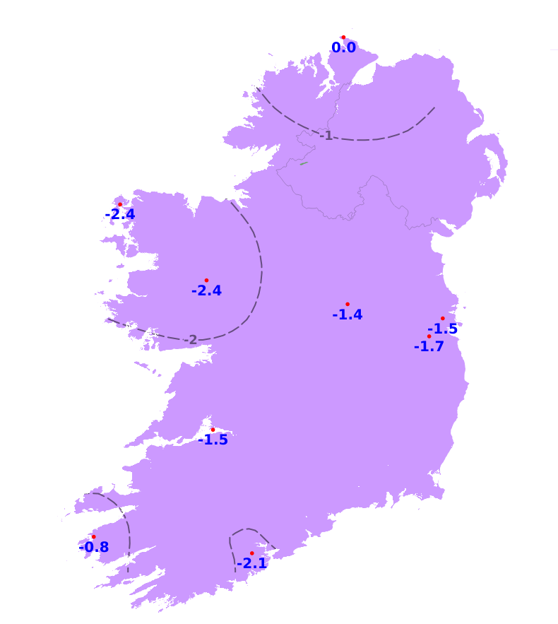
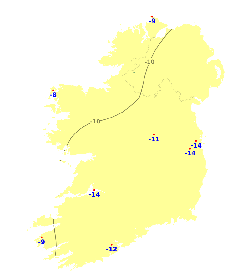
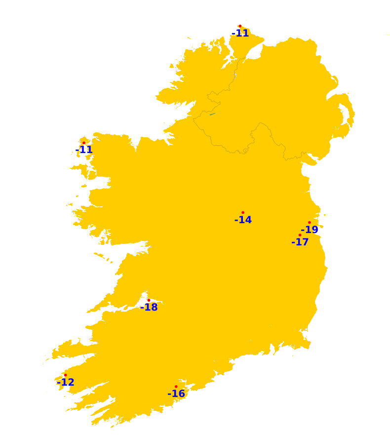
Mean air temperatures over the last seven days were generally around normal or a little above, though slightly below normal in the far north, with mean air temperatures ranging from between 8.6 to 10.8 degrees. It is expected to become milder over the next seven days, with mean air temperatures rising to 12 or 13 degrees, which is 2 or 3 degrees above average. At the moment, mean soil temperatures are generally 1 or 2 degrees above normal, ranging from 8.8 degrees in the northwest to 11.4 degrees in the southwest. Soil temperatures will rise a little more this coming week.
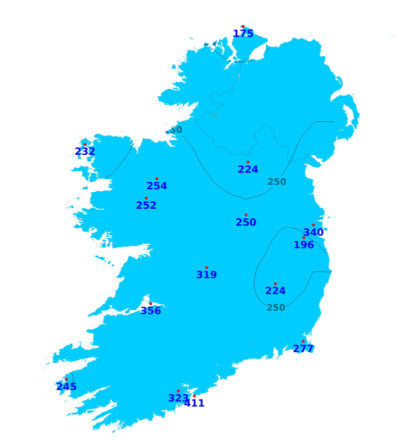
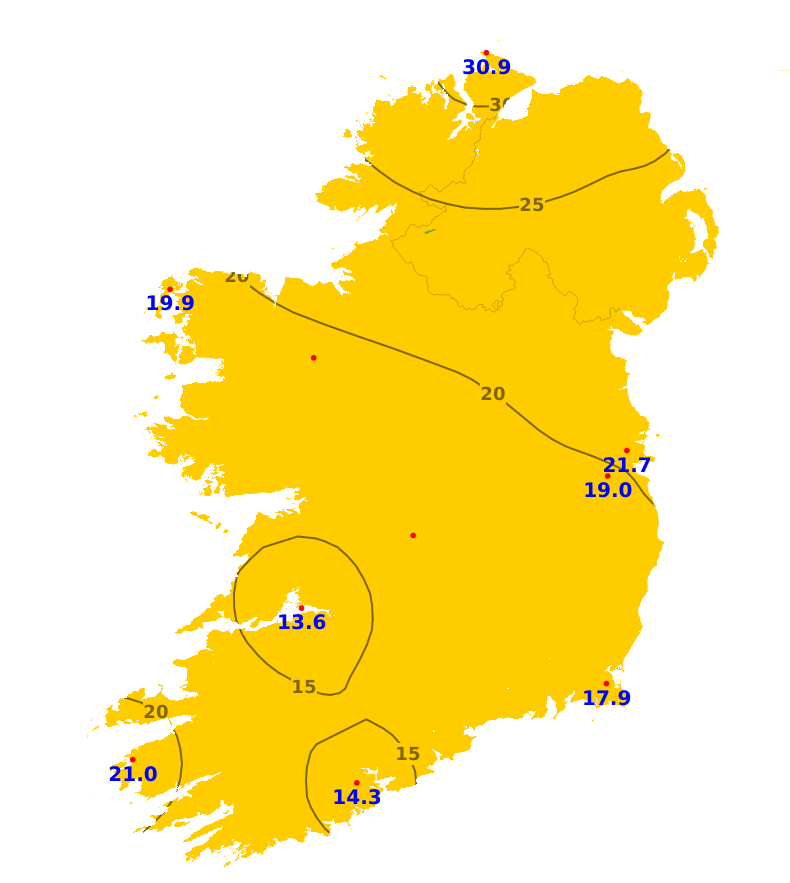
Sunshine
It has been duller than normal across the country over the last week. It was dullest in parts of the west with just 12.2 hours of sunshine recorded at Shannon Airport (33% of average). The highest amount of sunshine was recorded at Malin Head, Co. Donegal, where 30.8 hours were recorded (82% of average). Sunshine amounts will likely trend above average for the coming week.
Drying Conditions
There'll be some good drying conditions from Monday with drier and breezier weather forecast.
Spraying
There'll be some good opportunities for spraying on Saturday and from Monday.
Field Conditions
Most well drained and moderately drained soils are close to saturation or waterlogged, while most poorly drained soils are waterlogged. All soils will become drier by the end of the coming week, with soil moisture deficits increasing to between 3 and 7mm for moderately drained and well drained soils.
Forecast maps and meteograms can be found on Blight Forecast.