Updated on 30th December 2024, valid until further notice
Model certainty with respect to the track of the low pressure system on Tuesday night into Wednesday has improved with the majority of solutions keeping its track to the south of the country, therefore we are not expecting any significant severe weather related to it this system. For more details on the weather for the week, check our End of Year Forecast.
Issued 29th December 2024, valid until further notice
A series of low pressure centres are currently developing out in the Atlantic and the first of which is expected to pass over the country this Tuesday followed by another more significant area of low pressure on Wednesday.
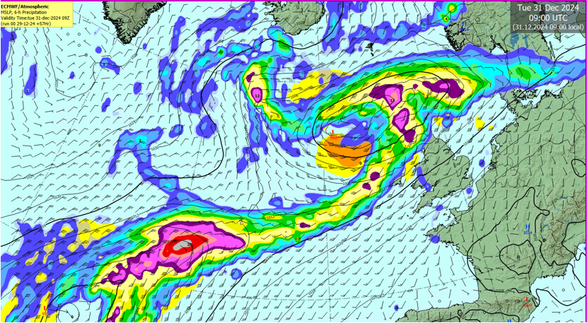
Tuesday’s weather is expected to be very unsettled with heavy rain passing down over the country throughout the day.
Met Eireann Meteorologist Mark Bowe commented “the low moving over on Tuesday will bring significant winds to the northwest but rain will be widespread and rather heavy at times too which could lead to spot flooding.”
The forecaster went on to explain that the weather on Wednesday will prove to be a lot more significant with more rain and very strong and blustery winds for all areas.
Bowe continued “ we are currently tracking the development of the low pressure system expected for Wednesday with potentially some very impactful winds across western and southern areas.”
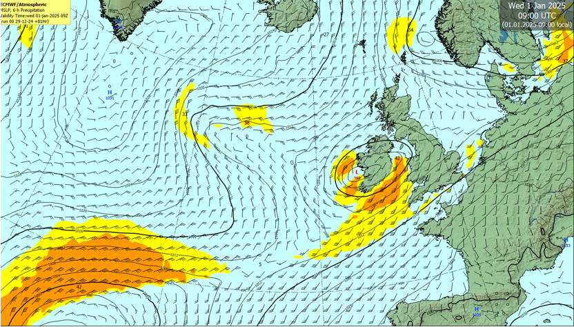
For now the low looks set to track right across the country with significant winds expected for western and southern areas.
Met Eireann’s flood forecasting centre also commented on the significant weather expected adding that soils are saturated or approaching saturation countrywide which will increase rainfall runoff to the rivers. The widespread and prolonged nature of the rain may lead to significant river level increases. There is the potential for surface water flooding where highest rainfall totals are observed.
They went on to mention that we are in a entering spring tides. Significant surge, wind and wave conditions are expected. Coastal inundation is not expected, however, exposed low-lying coastal areas may experience wave overtopping due to strong on-shore winds coinciding with high tide.
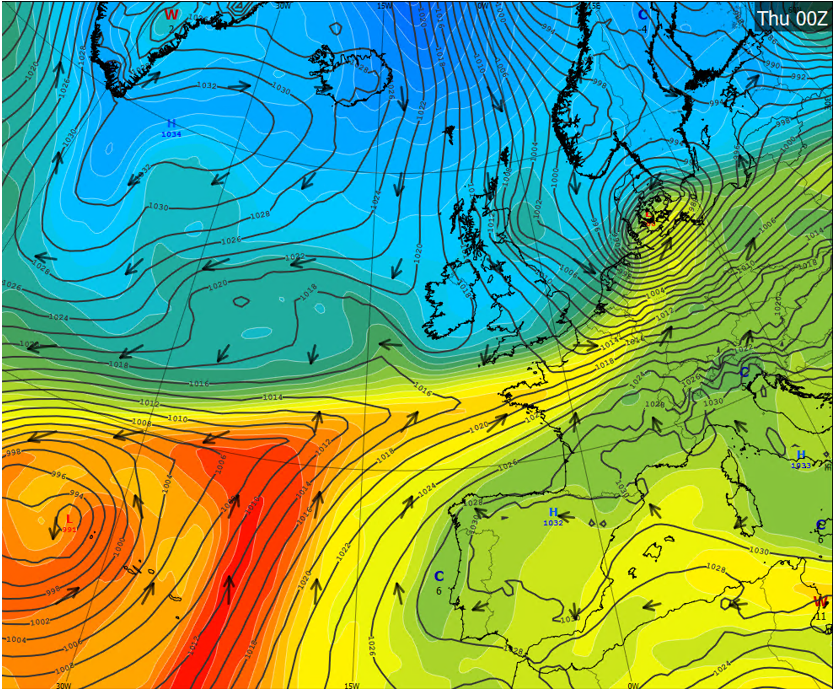
Beyond this weather mid-week we are going to experience a rather cold change to the overall regime with very cold northerly air set to sink down across the country to finish out the week. Temperatures are likely to fall well below freezing overnight and struggle to remain in the single figures during the day.
For now Met Eireann forecasters are closely monitoring the situation with special emphasis on the development of the weather for Wednesday with updates likely over the coming days.
Potentially significant and impactful weather in store this Tuesday and Wednesday followed by a sharp cold snap to finish out the week. - UPDATED
Updated on 30th December 2024, valid until further notice
Model certainty with respect to the track of the low pressure system on Tuesday night into Wednesday has improved with the majority of solutions keeping its track to the south of the country, therefore we are not expecting any significant severe weather related to it this system. For more details on the weather for the week, check our End of Year Forecast.
Issued 29th December 2024, valid until further notice
A series of low pressure centres are currently developing out in the Atlantic and the first of which is expected to pass over the country this Tuesday followed by another more significant area of low pressure on Wednesday.
Tuesday’s weather is expected to be very unsettled with heavy rain passing down over the country throughout the day.
Met Eireann Meteorologist Mark Bowe commented “the low moving over on Tuesday will bring significant winds to the northwest but rain will be widespread and rather heavy at times too which could lead to spot flooding.”
The forecaster went on to explain that the weather on Wednesday will prove to be a lot more significant with more rain and very strong and blustery winds for all areas.
Bowe continued “ we are currently tracking the development of the low pressure system expected for Wednesday with potentially some very impactful winds across western and southern areas.”
For now the low looks set to track right across the country with significant winds expected for western and southern areas.
Met Eireann’s flood forecasting centre also commented on the significant weather expected adding that soils are saturated or approaching saturation countrywide which will increase rainfall runoff to the rivers. The widespread and prolonged nature of the rain may lead to significant river level increases. There is the potential for surface water flooding where highest rainfall totals are observed.
They went on to mention that we are in a entering spring tides. Significant surge, wind and wave conditions are expected. Coastal inundation is not expected, however, exposed low-lying coastal areas may experience wave overtopping due to strong on-shore winds coinciding with high tide.
Beyond this weather mid-week we are going to experience a rather cold change to the overall regime with very cold northerly air set to sink down across the country to finish out the week. Temperatures are likely to fall well below freezing overnight and struggle to remain in the single figures during the day.
For now Met Eireann forecasters are closely monitoring the situation with special emphasis on the development of the weather for Wednesday with updates likely over the coming days.
About Us