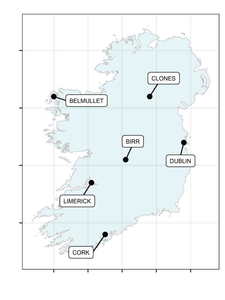
A set of weather and climate data files have been produced for use in building energy models when designing new buildings. These are available at six locations around Ireland, shown in the map below. These come in the form of both a Test Reference Year (TRY) and 3 Design Summer Years (DSY), for both past data and future projections.
They are part of the output of work package 5 of Action 203 of Ireland’s Climate Action Plan 2021 – Develop specific climate maps and data for use in building design to enhance resilience in support of climate change adaptation. These data are freely available in .csv format, with information on accessing the files given in the tabs below. Further details on the methodologies used can be found in the linked report.
Read the full report:
Griffin, S., Mateus C., and Lambkin, K. 2023. Climate data for use in building design – Past and Future weather files for overheating risk assessment. Climatological Note No. 21. Met Éireann.
Test Reference Year (TRY)
The TRY aims to capture average conditions that are likely to affect a building. This file is created on a month-by-month basis. A 30 year climate period is considered, in this case 1991-2020. For a given month a statistical metric, the Finkelstein-Schaefer statistic, was used to select the most representative month from the 30 year dataset (Eames et al. 2016). This was then repeated for all 12 months of the year to produce a composite collection of 12 months that represent the most average conditions that are expected to be experienced at that location.
Future TRYs have been produced using output from TRANSLATE, which has developed a standardised ensemble set of climate projections for Ireland. This produced climate projections for 27 different scenarios: combining 3 time periods, 3 emission scenarios and 3 model sensitivities (based on the temperature response to a given emission scenario). The widely used “delta-change method” (Michel et al. 2021) was used to produce future TRY files at hourly resolution for each TRANSLATE scenario, and using the same methodology used to select the past TRYs.
The list of TRY files for each of the locations are listed in the linked document. These files have been produced in .csv format. Please email enquiries@met.ie citing the appropriate product code in your email to access the data for free.
Design Summer Years (DSYs)
The DSYs are selected to simulate overheating scenarios of varying intensity. The DSY1 is chosen to represent a year with a moderate overheating event, based on certain selection criteria (Eames, 2016). The remaining DSY2 and DSY3, are chosen from the remaining years which are more extreme than DSY1. DSY2 is a year which contains an overheating events with a prolonged duration and DSY3 is a year which contains a short, intense overheating event. Due to the nature of the weather, some years contained both long duration and short, intense warm spells. In these cases, best judgement was used to allocate the year to the most appropriate DSY.
Future DSYs have been produced using output from TRANSLATE, which has developed a standardised ensemble set of climate projections for Ireland. This produced climate projections for 27 different scenarios: combining 3 time periods, 3 emission scenarios and 3 model sensitivities (based on the temperature response to a given emission scenario). The widely used “delta-change method” (Michel et al. 2021) was used to produce future DSY files at hourly resolution for each TRANSLATE scenario, and using the same methodology used to select the past DSYs.
The list of DSY files for each of the locations are listed in the linked document. These files have been produced in .csv format. Please email enquiries@met.ie citing the appropriate product code in your email to access the data for free.

