Sea Area Forecast
Forecast valid from: 00:00, Saturday 22 February 2025 until 00:00, Sunday 23 February 2025
Small Craft Warning
Southwesterly winds will reach force 6 or higher at times overnight and early on Saturday morning on Irish coasts from Carnsore Point to Loop Head to Fair Head, becoming confined to coasts from Loop Head to Erris Head to Fair Head from mid-morning until evening
Gale Warning
Atlantic Swell
On southwest, west and north coasts
Meteorological Situation at 21:00 UTC
Depressions close to Iceland maintain a fresh to strong southwesterly airflow over Ireland with showery troughs embedded in the flow.
Small Craft Warning: In effect
Heavy Swell (>4m) : yes
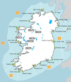
Forecast for Irish coastal waters from Mizen Head to Erris Head to Fair Head
Wind: South to southwest force 6 or 7, decreasing southwesterly force 5 to 7 imminent, soon decreasing west to southwest force 4 to 6, strongest north of Loop Head, later becoming southerly and increasing force 6 to gale force 8 by the end of the period.
Weather: Occasional showers with isolated thunderstorms and hail possible, becoming isolated later on Saturday.
Visibility: Moderate or poor in showers, otherwise good
Forecast for Irish coastal waters from Fair Head to Wicklow Head to Mizen Head and for the Irish Sea
Wind: South to southwest force 5 or 6, decreasing force 4 or 5 imminent, later decreasing force 3 or 4, then backing southerly and increasing force 5 to 7 by the end of the period, strongest on the south coast.
Weather: Some showers on the south coast, mainly fair on the east coast.
Visibility: Moderate or poor in showers, otherwise good
Outlook for a further 24 hours until 00:00, Monday 24 February 2025
Southerly gales or strong gales developing on all coasts, veering south to southwest on Sunday afternoon and gradually decreasing strong to gale force, strongest in the northwest. Persistent or heavy rain spreading eastwards, clearing on Sunday afternoon with showers following.
Forecast issued at: 00:00, Saturday 22 February 2025
All times are local unless specified