Sea Area Forecast
Forecast valid from: 06:00, Monday 23 February 2026 until 06:00, Tuesday 24 February 2026
Small Craft Warning
Southwest winds will reach force 6 or higher at times on all Irish coasts through the period.
Gale Warning
Nil
Atlantic Swell
On Atlantic coasts through the period
Meteorological Situation at 03:00 UTC
A depression of 988 hPa about 285 nautical miles north-northwest of Malin Head moves eastwards and generates a fresh to near gale force unstable westerly airflow over Ireland. A warm front approaches from the south-westand will move northeastwards over Ireland today.
Gale Warning: In effect
Small Craft Warning: In effect
Heavy Swell (>4m) : yes
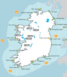
Forecast for Mizen Head to Slyne Head to Malin Head
Wind: West to south-west force 5 to 7, strongest north of Erris Head, backing south to south-west force 4 or 5 imminent, soon increasing southerly force 5 to 7, later increasing force 6 or 7
Weather: Isolated showers at first. Rain and drizzle spreading north-eastwards today. Further rain, drizzle and mist tonight.
Visibility: Mostly good, decreasing moderate or poor in rain, drizzle and mist
Forecast for Malin Head to Wicklow Head to Mizen Head and for the Irish Sea
Wind: Southwest force 5 to 7, strongest between Malin Head and Fair Head, backing south to southwest imminent, soon decreasing force 4 or 5 between Malin Head and Carnsore Pt, later becoming southerly force 4 to 6 for all of the region, increasing force 6 or 7 overnight.
Weather: Isolated showers at first. Rain and drizzle spreading north-eastwards today. Further rain, drizzle and mist tonight.
Visibility: Mostly good, decreasing moderate or poor in rain, drizzle and mist
Outlook for a further 24 hours until 06:00, Wednesday 25 February 2026
Fresh to strong southerly winds, reaching near gale force in the north-west for a time, decreasing moderate to fresh early on Tuesday night. Rain, drizzle and mist, rain becoming heavier in the west later on Tuesday and extending to all areas.
Forecast issued at: 06:00, Monday 23 February 2026
All times are local unless specified